
- [augering]
![]()
augering
by Jane Sidell
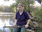
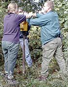
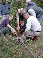
Augering is a technique used by environmental archaeologists to look at deposits below the ground surface without having to dig trenches. In this, it is similar to geophysical prospection. Augering consists of driving a probe into the ground, and collecting a sequence of soils and sediments within the probe. This can either be done by hand with a small auger, or mechanised versions may be used. The probe is then removed and the contents may be examined to see what type of environment, for example marshy, is represented in that probe.
The depth of drilling is accurately measured and, using this measurement along with the ordnance survey co-ordinates, the results may then be located in three dimensions.The results can then be used in conjunction with historical surveys and geophysical plots, for instance.
The technique is quick and can be used to cover large areas to examine how the sub-surface horizons change within the wider landscape, for example to search for ancient courses of rivers and streams. It may also be used to locate specific horizons such as burnt layers.

Jane Sidell of the Museum of London Archaeology Service


