

[Marshfield history]
![]()
history
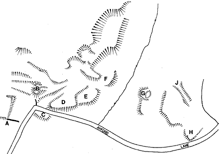
A plot of the earthworks of the deserted settlement at Ayford, in the south of Marshfield parish. It was mapped in 1744 (see book) and was deserted in the late 18th century, at the same time as the decline in the malting industry. The letters refer to the sites of houses.
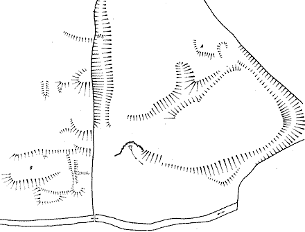
A plot of the earthworks at Brook House Green, close to West End Town and Castle Farm. At the lower right-hand side can be seen the earthworks of a building and other features by the stream, probably a mill site. On the other side of the wall, in the triangular green, can be seen hollow-ways running down to the building, and a large natural spring, emerging into what would have been the mill pond.
Back to Marshfield history